The National Hurricane Center indicates an increased likelihood of a tropical depression forming in the Caribbean Sea, specifically with Invest 95L, which has a 50 percent chance of development. Meanwhile, Invest 94L is unlikely to develop further due to adverse conditions. Heavy rainfall is expected in parts of Central America and southern Mexico this weekend, but impacts on the U.S. are not foreseen.
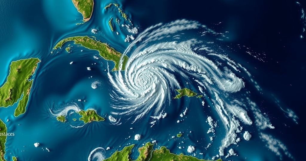
The National Hurricane Center (NHC) has increased the likelihood of a tropical depression forming in the Atlantic Ocean, particularly regarding a system in the northwestern Caribbean Sea, referred to as Invest 95L. This system is characterized by a broad area of low pressure that is generating considerable showers and thunderstorms in the vicinity. Recent advisories from the NHC indicate that this system is becoming more defined just north of eastern Honduras. The environmental conditions are favorable for further development within the next couple of days, suggesting that a temporary tropical depression or storm could emerge before the system progresses inland over Belize and into the Yucatan Peninsula of Mexico on Saturday. The NHC has assigned a 50 percent chance of formation for this system in the coming 48 hours. Regardless of whether the system develops further, significant rainfall is anticipated across parts of Central America and southern Mexico throughout the weekend. Additionally, the NHC is monitoring another system designated as Invest 94L, which consists of a poorly-defined trough of low pressure producing disorganized weather patterns extending from the northern Leeward Islands over the adjacent Atlantic waters. Forecasts indicate that this system is unlikely to evolve into a named storm due to prevailing strong upper-level winds, and it is projected to have only a 10 percent chance of development in the next 48 hours. It is set to move westward towards the Virgin Islands and Puerto Rico before reaching Hispaniola and the southeastern Bahamas. As the hurricane season progresses, the next designated names for any forthcoming storms are Nadine and Oscar.
The Atlantic hurricane season typically runs from June 1 to November 30, during which time various meteorological phenomena can develop into tropical storms or hurricanes. The National Hurricane Center plays a critical role in monitoring these systems, providing timely updates and forecasts that inform the public and help ensure safety. The identification and tracking of systems such as Invest 95L and Invest 94L are essential in predicting potential impacts on coastal regions and preparing affected areas for severe weather developments. The current systems provide insight into the prevailing meteorological conditions in the Caribbean region, with Invest 95L showing a significant chance of development, while Invest 94L is predicted to remain weak due to unfavorable conditions. Heavy rains and flooding can result from both systems, underscoring the importance of ongoing monitoring and advisories.
In summary, the National Hurricane Center has raised the possibility of a tropical depression forming in the Caribbean Sea, with the system Invest 95L posing the highest risk of development in the immediate future. While local heavy rainfall is anticipated regardless of the system’s evolution, the potential impact on the United States appears minimal at this time. Conversely, Invest 94L is not expected to develop further due to strong wind patterns inhibiting growth. Vigilance is essential as the hurricane season continues and forecasts might change rapidly with evolving weather patterns.
Original Source: www.usatoday.com