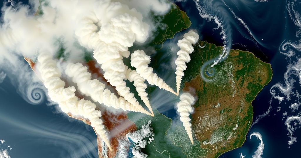
On August 28, 2024, the VIIRS instrument on the NOAA-20 satellite detected fires in Brazil and Bolivia, revealing thick smoke and thermal anomalies. Contributing factors include high temperatures, low humidity, and prolonged drought, impacting air quality and visibility due to elevated aerosol concentrations.
The Visible Infrared Imaging Radiometer Suite (VIIRS) aboard the joint NASA/NOAA NOAA-20 satellite detected numerous fires and thermal anomalies in Brazil and Bolivia on August 28, 2024. The accompanying imagery reveals substantial gray smoke emitted from ongoing fires, further exacerbated by prevailing high temperatures and prolonged drought conditions in the region. The provided images include a true-color reflectance overlay highlighting fire hotspots as red dots, alongside an Aerosol Index layer that indicates atmospheric pollution related to biomass burning and dust particles.
Fires in Brazil and Bolivia have drawn considerable attention due to the persistent environmental challenges posed by high temperatures, low humidity, and significant drought. The VIIRS satellite provides a crucial tool for monitoring these fires and their resulting smoke, which can have serious implications for visibility and public health. The Aerosol Index aids in understanding the concentration of pollutants, indicating an urgent need for comprehensive monitoring and management efforts in this context.
The ongoing fires in Brazil and Bolivia, as revealed by satellite imagery, underscore the urgent challenges posed by climatic factors such as drought and high temperatures. The significant presence of aerosols, as indicated by the Aerosol Index, highlights potential health risks associated with smoke exposure. Continuous monitoring through satellites like VIIRS is critical for assessing and responding to these environmental crises.
Original Source: www.earthdata.nasa.gov