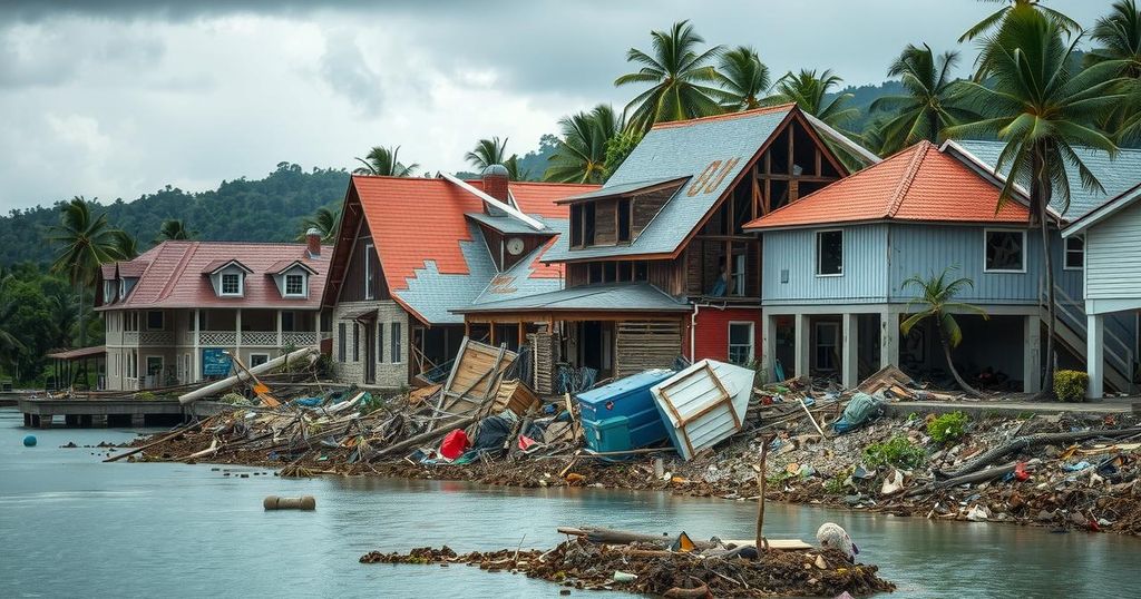
Cyclone Chido struck Mayotte on December 14, 2024, causing extensive damage with hurricane-force winds that destroyed homes and vegetation. Satellite images reveal drastic changes in the landscape, while significant impacts on food supply and infrastructure are reported. The storm particularly affected areas near the capital, Mamoudzou, signifying a critical need for recovery efforts.
On December 14, 2024, Cyclone Chido struck the islands of Mayotte, resulting in widespread destruction. Hurricane-level winds devastated homes, utility infrastructures, and the natural environment, transforming the vibrant greenery into a stark brown landscape. Satellite imagery captured by the Operational Land Imager (OLI) on Landsat 8 illustrates the dramatic damage inflicted on Grande Terre two weeks after the cyclone, revealing how vegetation was significantly impacted, particularly in hilly regions near Mamoudzou, the capital city.
Jess Zimmerman, an ecology professor at the University of Puerto Rico, has extensively researched the effects of hurricanes on ecosystems, noting that the damages from Cyclone Chido were particularly pronounced on steep hillsides. The destructive winds not only stripped trees of their leaves and broke branches, but also facilitated uprooting due to the saturation of the soil from heavy rains. Particularly vulnerable were the trees situated at higher elevations, where exposure to intensified winds heightened their susceptibility to destruction.
The aftermath of Cyclone Chido also witnessed the collapse of a centuries-old giant baobab tree, which fell onto a restaurant, highlighting the severe impact on local landmarks. The storm significantly affected food supply as banana trees and other crops were destroyed, threatening the food security of island communities. Additionally, there were substantial damages to vital infrastructure, including airports, hospitals, and roadways, impeding access to essential services such as electricity, water, and communications. A satellite assessment conducted by the European Commission revealed that the most severe destruction primarily occurred in the northeast region where the cyclone initially made landfall.
Cyclone Chido, categorized as a Category 4-equivalent storm, significantly impacted the French territory of Mayotte, located in the southwest Indian Ocean. This region, prone to severe tropical cyclones, can experience devastating environmental changes and infrastructure damage during such events. Understanding the effects of tropical cyclones is crucial for disaster preparedness and response, particularly in vulnerable locations like Mayotte. Observations of vegetation change following cyclonic activity provide insights into the ecological impact on local landscapes and biodiversity. The examination of satellite images before and after the cyclone is integral to assessing the extent of the damage and future recovery efforts.
In summary, Cyclone Chido’s impact on Mayotte was catastrophic, leading to significant ecological and infrastructural challenges. The devastation of the local landscape and the destruction of critical food sources underscore the urgent need for disaster preparedness in the face of such natural calamities. Moving forward, comprehensive assessments and recovery plans will be essential to restoring life on the island and ensuring the resilience of its communities against future storms.
Original Source: earthobservatory.nasa.gov