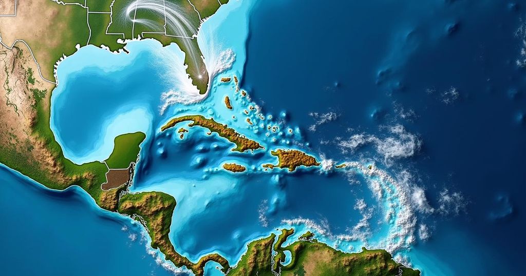
The National Hurricane Center is monitoring tropical disturbance Invest 94L, which is expected to approach the northeastern Caribbean islands by Friday. Current conditions are not conducive for development, but as the system nears Puerto Rico, the likelihood of progression to at least a tropical depression may increase. Residents in affected areas should remain informed, while Florida seems to be safe from the disturbance.
Bryan Norcross has reported that the tropical disturbance known as Invest 94L continues its course westward through the mid-tropical Atlantic. Currently, conditions are not favorable for development due to extremely dry air preventing thunderstorms from forming within the system. However, predictions indicate that as the system approaches the northeastern Caribbean islands around Friday, the atmospheric conditions may become more conducive for development. It is important to note that this time of year presents a rare opportunity for a tropical disturbance originating from Africa to progress toward the Caribbean, as ocean waters usually cool and upper-level winds become less favorable for such systems. Nevertheless, the present warm ocean temperatures and an unusual high-pressure bubble just north of the disturbance are facilitating its atypical trajectory. Satellite imagery has shown emerging thunderstorms attempting to develop near the center of the disturbance, albeit in a mostly disrupted formation. The National Hurricane Center has assessed the likelihood of the system developing into at least a tropical depression as it approaches waters near or north of Puerto Rico and the nearby islands, labeling this chance as medium. There is consensus among computer forecast models that the disturbance will reach this vicinity around Friday. However, the nature of its development could range from merely a moisture increase to strong systems with well-defined circulations. Post-Friday, steering currents are predicted to weaken, causing the system to drift towards Puerto Rico, the Dominican Republic, Haiti, or the southeastern Bahamas. As this occurs, it is plausible that some islands may encounter impacts from a tropical storm or hurricane. It is crucial to recognize that when steering flow is ambiguous, uncertainty regarding the track increases. Therefore, vigilance among residents in Puerto Rico, the Virgin Islands, Hispañola, the southeastern Bahamas, and surrounding areas is advised throughout this week. Fortunately, there seems to be no direct threat to Florida, as a cold front situated across South Florida coupled with a dip in the jet stream over the Bahamas is likely to steer tropical systems away from the state. However, it is imperative to allow the disturbance to develop further for increased forecasting confidence. As with all predictions regarding the trajectories and strength of undeveloped or just-emerging tropical systems, uncertainties are inherent and assessments are subject to modification based on evolving conditions.
This article underscores the monitoring of a significant tropical disturbance named Invest 94L, which is traveling through the tropical Atlantic. This system has garnered attention due to its potential to develop as it nears the Caribbean islands, particularly Puerto Rico. The report outlines the current dry atmospheric conditions inhibiting development, projections for possible improvements in these conditions, and the unusual timing and trajectory of the disturbance as it approaches warmer waters. Additionally, it provides insight on the implications for regions in the Caribbean and assesses risks for the state of Florida.
In summary, while the tropical disturbance Invest 94L demonstrates limited development potential in its initial stages, conditions may change favorably as it nears the northeastern Caribbean by Friday. Residents of Puerto Rico and surrounding areas should remain alert for potential impacts from this system, while Florida appears to be safeguarded from any immediate threats. Ongoing monitoring and updates will be essential to provide accurate forecasts as the situation unfolds.
Original Source: www.foxweather.com